Below are scans of system maps which come from pages 6 and 7 in public time tables. (Eventually this section will also contain both route and track maps for the Chicago Aurora & Elgin and the Third Rail Division of the Aurora Elgin and Chicago Railroad.) Also available is a Google Map showing the route of the Chicago Aurora & Elgin in relationship to current conditions.
In the intervening years since the Chicago Aurora & Elgin faded into memory, much of the land around the railroad has changed. This often makes it difficult to identify the locations of things in a present day setting. Thanks to the efforts of May Theilgaard Watts and numerous volunteers, most of the right of way has been preserved as the Illinois Prairie Path, a sixty-one mile multi-use trail.
The map to the left uses satellite imagery and outlines the route of the line from the Wells Street Terminal over the Garfield Park “L” to the four terminals along the Fox River. Pinpointing historic locations in relation to current day topography has been accomplished through the comparison of aerial photographs from the 1930s, ‘40s, and ‘50s with their present day counterparts in addition to consulting published route maps and the track maps in CERA Bulletin 105: The Great Third Rail and in Sunset Lines Volume 1.
The lines and station markers are color coded for easy identification of services. Blue lines and markers indicate that the route was served only by Chicago Aurora & Elgin interurban trains (excluding special rapid transit excursions). Red lines and markers indicate lines and stations that were exclusively served by the rapid transit lines, while purple lines and markers show locations where both the interurban and rapid transit operated either simultaneously or at different points in history.
In areas where there were two tracks, the line roughly represents the center point between tracks. For single track areas, the line closely approximates track location.
Click here to view a larger version of this map with extra features including the options to highlight bicycle paths and transit lines.

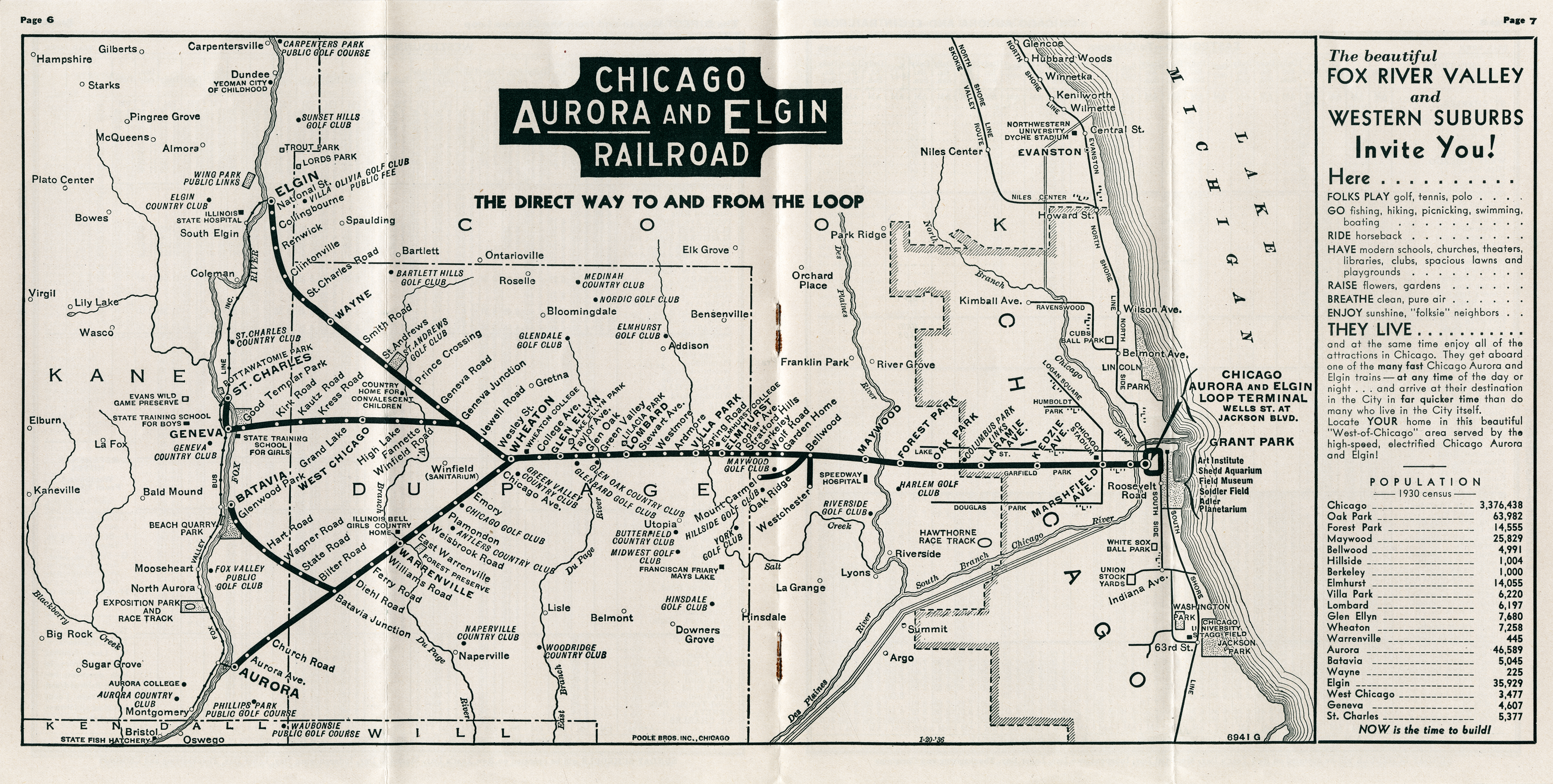
May 5, 1934
July 1, 1937

November 8, 1942
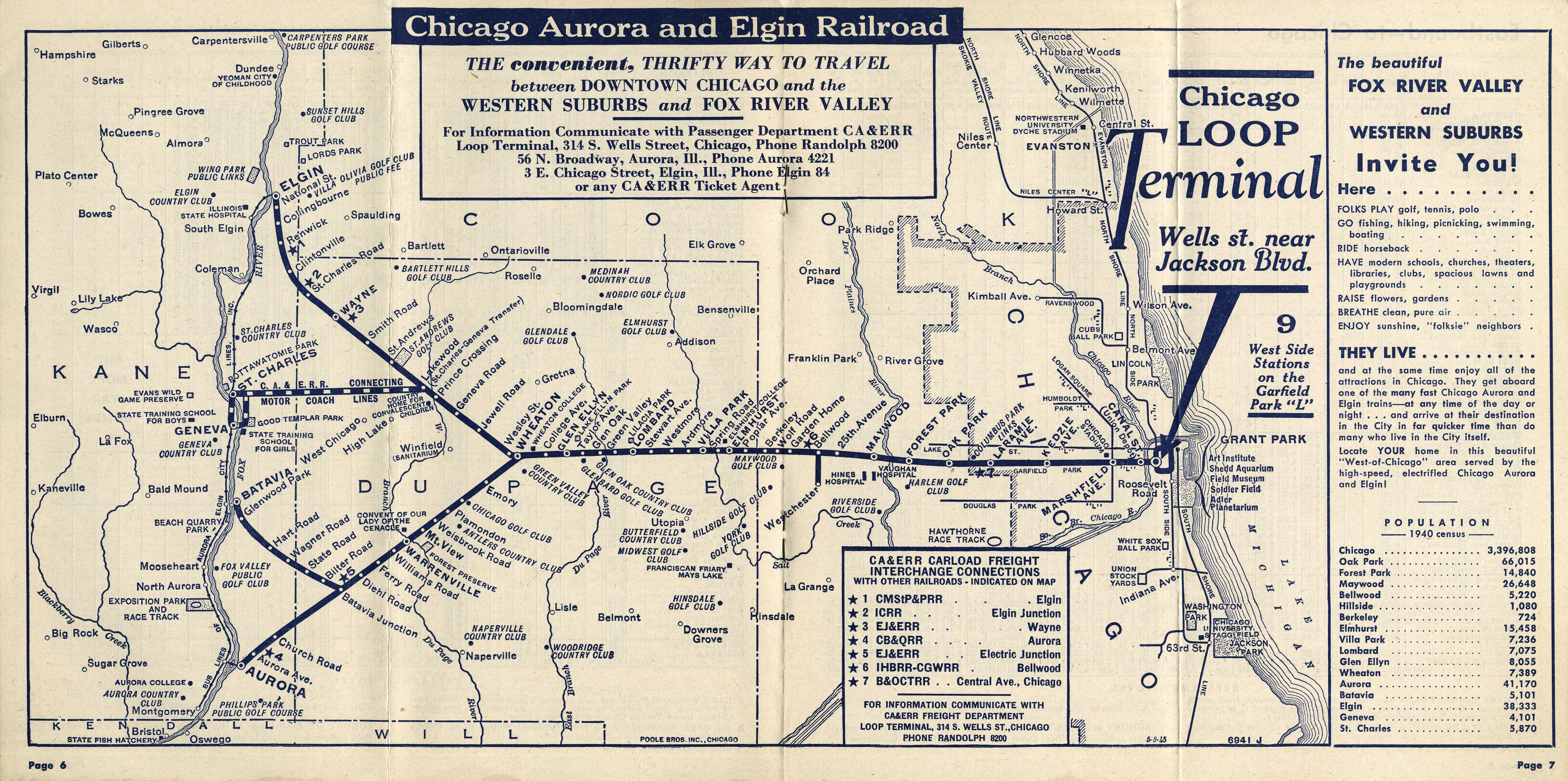
June 10, 1945
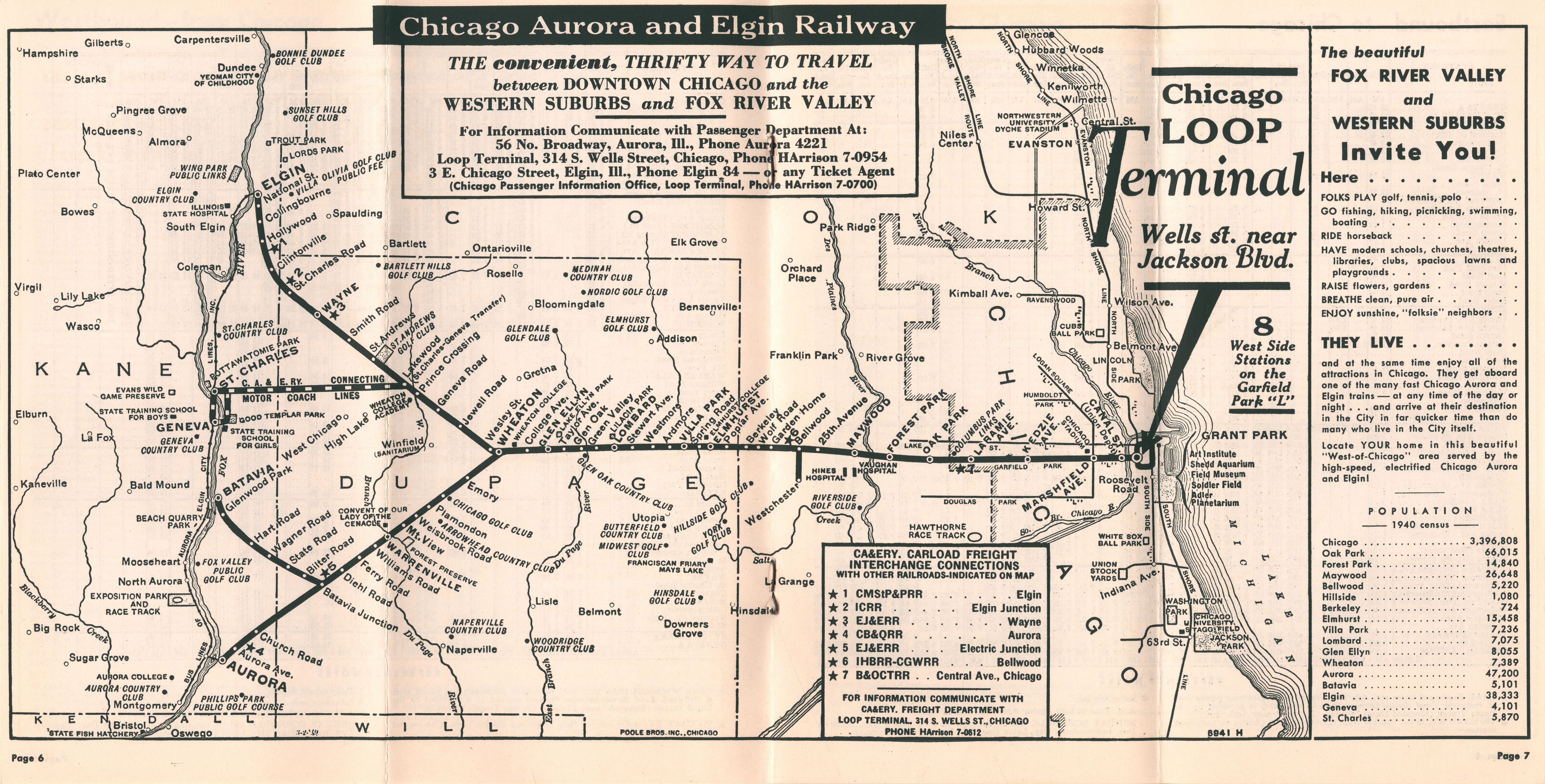
June 14, 1948
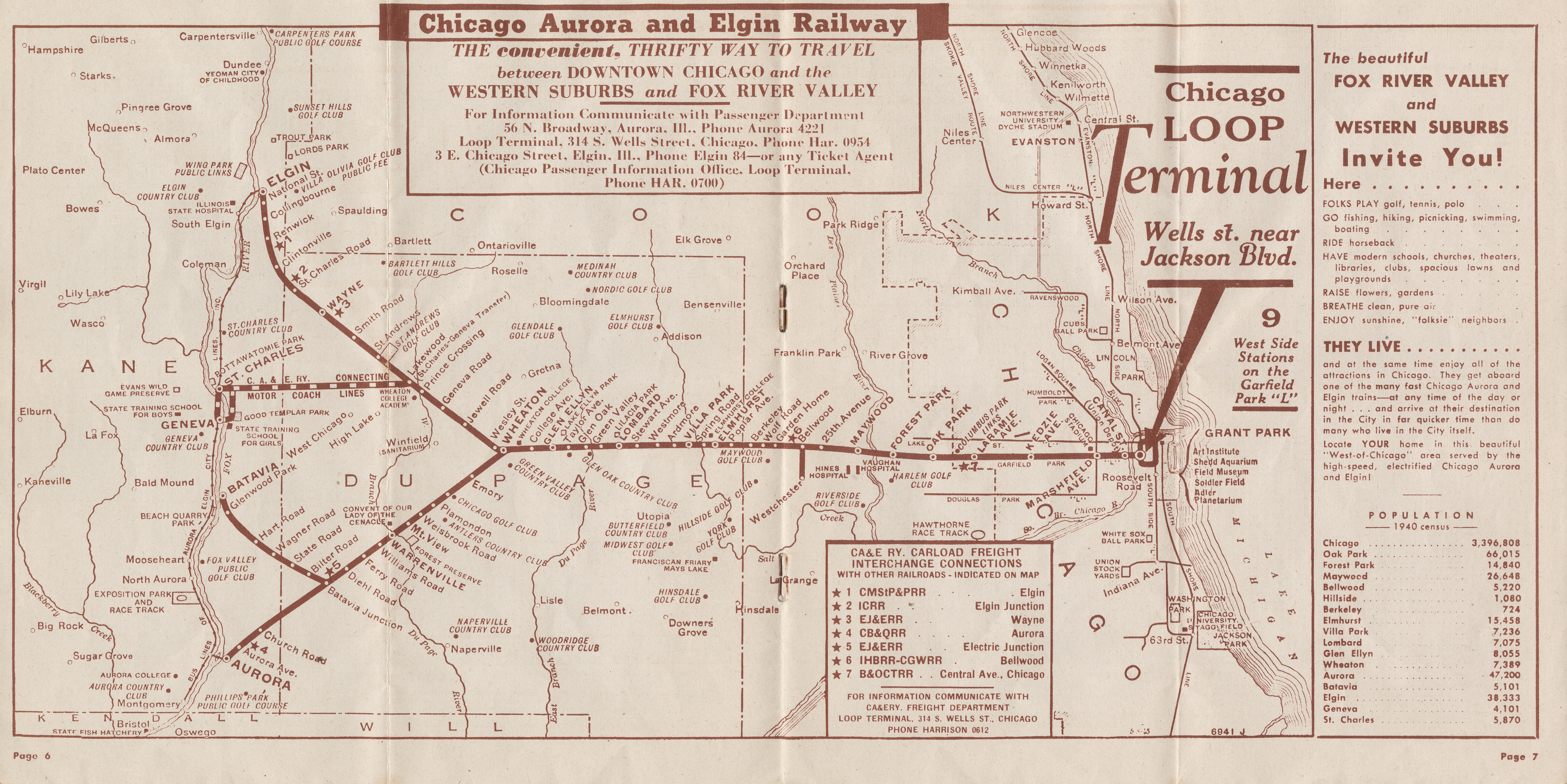
July 11, 1949
